Training Schedule
The in-person training will cover severe weather hazards including thunderstorms and tornadoes, safety concerns, planning for and anticipating severe thunderstorms, general storm structure and movement, and identification of important storm features. New this year are more interactive portions of the sessions.
Other Spotter Training Options
Online Spotter Training Classes (through COMET MetEd)
There is NO COST to take the two, 45 minute modules which make up this training:
"Role of the SKYWARN Spotter" and "SKYWARN Spotter Convective Basics"
All you need is a login account & password on the MetEd web page.


Surrounding NWS Office Spotter Training:
Spotter Resources
1) Online Spotter Training Classes (through UCAR MetEd)
There is NO COST to take the two classes which make up this training:
"Role of the SKYWARN Spotter" and "SKYWARN Spotter Convective Basics"
All you need is a login account & password on the MetEd web page.
Important Note: You are still HIGHLY encouraged to attend a virtual spotter training class in 2021 to learn about local effects and local reporting procedures. The MetEd classes are intended as either a brief introduction to severe storm spotting OR as a refresher for spotters who have attended a class in the last few years.
2) NWS Lincoln YouTube videos:
We have placed our spotter training on our YouTube page. You can either view all the videos at once (approximate run time 36 minutes), or broken down by topic. However, in order to become a certified storm spotter, you either need to attend a class in person, or take the online class above.
| Topic | Length |
| Introduction | 2:12 |
| Thunderstorm Development | 4:15 |
| Characteristics of Severe Storms | 2:00 |
| Thunderstorm Types | 3:16 |
| Non-Supercell Tornadoes and Other Rotations | 3:18 |
| Squall Lines | 3:11 |
| Supercells | 6:09 |
| Challenges While Spotting | 2:26 |
| Spotter Safety: Escape Routes | 2:15 |
| Spotter Safety: Lightning, Flooding and Tornadoes | 3:38 |
| Submitting Severe Weather Reports | 3:34 |
3) Additional Resources for Storm Spotters
Note: Utilizing these items does NOT make you a trained spotter. These are intended as resource material only. If you have an interest in storm spotting please attend a spotter class in your area.
Spotter's Field Guide (1.9 MB PDF) NOAA / NASA Sky Watcher Cloud Chart
NWS Lincoln Spotter Info Handout
From the Storm Prediction Center:
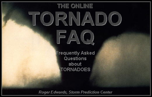

Photo by Brittney Misialek
Frequently Asked Questions Facts About Derechos
About Tornadoes
Sign-up to be a SKYWARN spotter
To register with NWS Lincoln, IL as a SKYWARN Spotter click the SKYWARN logo to the right:
 Become a Spotter for NWS Lincoln IL
1) Begin by attending a virtual spotter training class. These are scheduled between March and mid-April. Classes are FREE and take about 1.5 to 2 hours to complete. Anyone can attend a class, but you must be at least 18 years of age to sign-up to be a SKYWARN spotter. The training, taught by NWS meteorologists, is comprised of all of the information that spotters need to be effective and stay safe.
Topics covered in the spotter training class include:
IF you can not attend one of the local spotter classes, there are two online training modules you can take to introduce yourself to the basic spotting concepts. CLICK HERE to access the online spotter training modules.
2) After you have completed a spotter training class, and if you are interested in reporting directly to the NWS Lincoln office you can sign-up to become a SKYWARN spotter. You must be at least 18 years of age to sign-up to be a SKYWARN spotter. CLICK HERE to access the form to sign-up to be a SKYWARN spotter.
NOTE : We will cross-check your name on the sign-in sheet for the spotter class you attended. If it is NOT there you will NOT be entered into our database!
3) Report to the NWS Lincoln office as soon as possible, when you witness rotations, flooding / heavy rain, high wind or wind damage, large hail, or damage caused by lightning.
What Should Spotters Report? 
Important points to remember during severe weather:
What to Report to the National Weather Service:
1. Tornadoes
2. Funnel Clouds, Rotating Wall Clouds or any other rotations
3. Flooding / Heavy Rain
a. Rapidly rising creeks, streams or rivers
b. High water on city streets or rural roads, 6” or more in depth AND any road closures, especially in areas that do not normally flood
c. Heavy rainfall that is accumulating at rates of 1 inch per hour
4. High Wind – around 60 mph and greater
(Note: Report high wind even if it is not associated with a thunderstorm)
a. 40 to 55 mph – small tree branches broken off
b. 55 to 70 mph – large tree branches broken off, shallow rooted trees
blown over, damage to chimneys, guttering, roofing and sheds.
c. Greater than 70 mph – heavy damage to structures such as roofing torn off, power poles snapped, trailers overturned, large trees blown over.
5. Damage caused by the Wind
a. Size and number of trees / tree limbs blown down.
Are the trees / limbs healthy? Damage to crops. 
b. Damage to homes, mobile homes/trailers, outbuildings/garages, and vehicle
c. Power poles or power lines blown down.
6. Large Hail (1.00" or greater in diameter)
|
Hail Size
|
Description
|
Hail Size
|
Description
|
|
0.25”
|
Pea
|
1.75”
|
Golf Ball
|
|
0.50”
|
One Half Inch
|
2.00”
|
Lime
|
|
0.70 - 0.75”
|
Dime to Penny
|
2.50”
|
Tennis Ball
|
|
0.88”
|
Nickel
|
2.75”
|
Baseball
|
|
1.00”
|
Quarter
|
3.00”
|
Large Apple
|
|
1.25”
|
Half-Dollar
|
4.00”
|
Softball
|
|
1.50”
|
Ping-Pong Ball
|
4.50”
|
Grapefruit
|
7. Lightning Damage
a. Injuries or fatalities due to a lightning strike
b. Property damage due to a lightning strike
How to Make a Report
If you observe severe weather in central or southeast Illinois, please make a report as safely & as soon as possible to one of the following locations:
 Email Send us an email: nws.lincoln@noaa.gov
.png) Facebook
Facebook
Put reports on our Facebook page: https://www.facebook.com/NWSLincoln
![]() Twitter Send us a tweet: @NWSLincolnIL
Twitter Send us a tweet: @NWSLincolnIL
 Online Form
Use this web form to submit reports: https://inws.ncep.noaa.gov/report/
![]() Mobile App Send reports via a smartphone app: MPing
Mobile App Send reports via a smartphone app: MPing
|
Q. What is a storm spotter? A. The National Weather Service's (NWS) primary mission is to save lives and protect property through the issuance of warnings for hazardous weather. The WSR-88D Doppler Weather Radar is a great tool for detecting and tracking potentially severe storms and essentially all strong and violent tornadoes. However, NWS meteorologists also depend on real-time reports from trained spotters to know exactly what is occurring on the ground under a storm. The NWS trains people to identify severe storms and tornadoes and report them via organized communications networks (primarily local and county emergency management, law enforcement and amateur radio).
Q. What is the difference between a storm spotter and a storm chaser? A. A storm spotter is volunteer, or paid county or municipal employee who is spotting as a community service. Most spotters work as part of an organized network and are in communication with their community or organization, which is in turn in communication with the NWS. Some spotters are "mobile" spotters in vehicles, but most spot from fixed locations, such as from home, work, or around the community. The purpose of spotting is to alert community officials and the NWS and assist them in warning the public. Schools, hospitals, and other facilities are encouraged to have spotters to alert people in their care of impending severe weather. Storm chasing involves following a developing thunderstorm to view or photograph severe weather phenomena. Chasing may be done for educational purposes or scientific research but is mostly done for personal fulfillment. Q. I want to be a storm chaser. What should I do? A. College of DuPage in Glen Ellen offers storm chasing field trips that are open to students and the public. There are private firms, mostly in the Great Plains, that offer storm chase tours/vacations. Many can be found through an internet search. Q. How do I become a spotter? A. Attend a basic severe weather spotter class. Classes are held throughout the area, they are free and open to the public. The class takes about 2 hours. Most classes are held weekday evenings. The training is generally done from March into early April - before severe weather season. The training consists of a slide and video program which teaches potential spotters about severe storm structure, and how to identify cloud features and other environmental clues to identify severe storms and tornadoes. Communications systems are explained so the spotter knows where to report, and how that information is used by the NWS and local officials. A complete schedule of classes can be found on our website from about February through April. Q. Is there a minimum age requirement to become a spotter? A. Because of the complexity of severe thunderstorm structure and development, and the potential danger involved, spotting is recommended for adults. However, people of all ages attend spotter training classes. Those ages 10 and up are likely to get the most from the class. Youth who are interested in attending a spotter training class are welcome to attend with a parent or other adult.
A. The NWS Lincoln office does not issue spotter ID numbers. Certificates are available on request. Some county emergency management agencies issue IDs and/or certificates. Please check with your local officials. Q. Does the NWS have any training material? A. In the past, the NWS has been able to hand out copies of the Basic Spotters' Field Guide. However, due to limited budgets, the NWS has made the Field Guide available online. You can find it at: https://www.weather.gov/media/ilx/Spotter_Training/SpottersGuideNew.pdf A pair of online spotter training modules are also available as a good introduction to severe storm spotting. These modules are free - all you need is an account on the COMET MetEd web page. For more info or to take the modules go to : https://www.meted.ucar.edu/training_course.php?id=23
For additional questions or more information about spotter training in central or southeast IL, contact the NWS Lincoln Warning Coordination Meteorologist, Ed Shimon at Edward.Shimon@noaa.gov
|


 Follow us on YouTube