When power goes out and weather emergencies escalate, the need for emergency managers to communicate information with constituents and stakeholders becomes indispensable. Nowadays, access to secure, scalable computing capacity, and availability in the cloud that can seamlessly integrate with existing workflows makes communications in a crisis possible. By pairing real-time situational analysis with on-demand map delivery, communities, stakeholders, and constituents can be kept informed like never before whenever extreme weather and other high-impact events affect lives, property, and communities.
Managing community power expectations as the climate changes
Recent events like drought, extreme flooding, intense tornadoes, and catastrophic wildfires aren’t likely to improve as the climate continues to warm. In fact, they could get much worse even as the costs of repairing and restoring power continue to skyrocket. The U.S. Department of Energy reports that power outages caused by weather-related events have become more common since 1992, costing an average of about $18 billion to $33 billion per year in the United States.
As climate-driven disasters continue to pose a threat to human life and grid reliability, electric service providers have an opportunity to identify scalable outage management solutions that will ensure reliable support when their customers need it most.
Reliable and scalable service to serve millions of customers
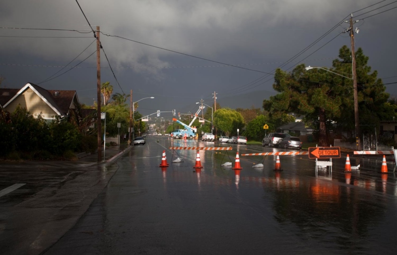
Whether due to a severe storm, brownout, blackout, or other significant events, loss of power causes significant anxiety in the community. For utilities and emergency management professionals, it’s crucial that they deliver timely, accurate information to allay those fears and restore services to impacted communities. That’s why a growing number of state and local governments, investor utilities, and municipal and utility cooperatives have turned to the DataCapable® Platform™. DataCapable’s Outage & Event Map helps mitigate community anxiety by providing an instant visual communications gateway to remain in communication with constituents.
The backbone of the DataCapable Platform is built on Amazon Web Services’ backend cloud architecture, on demand 99.99% of the time to maintain steady, predictable performance regardless of demand. With robust auto-scaling that monitors multiple applications simultaneously, the DataCapable Platform’s system displays only the information that’s specific to partner utilities and public safety entities. This allows emergency managers to keep customers informed in real time when there’s a threat to the community.
The DataCapable Platform is built for emergency response coordination
The DataCapable Platform is a collection of real-time threat detection, visualization, and communication tools backed by analyst-verified data points. It provides utilities, government agencies, smart cities, and emergency management teams with an instant visual gateway to remain in communication with their team and constituents before, during, and after high-impact events and outages. The Platform empowers emergency management operations centers and crews in the field with real-time, actionable information to assess and respond quickly and decisively to problems in the earliest moments of a crisis – before events escalate.
DataCapable’s Outage & Event Map delivers timely insights to customers and stakeholders through reliably communicating areas most affected, crew activity, estimated times of restoration, and how aid was mobilized to get power restored. Mapping events during a crisis enables organizations to become the go-to source for news when an emergency strikes. By leveraging simple-to-use visual communication tools, customers are provided with effective, efficient methods of detailing where and when events are occurring.
The emergence of fully interoperable geospatial information systems (GIS) and tools like the DataCapable Platform are changing the processes and workflows at utilities from coast to coast.
Via desktop or mobile device, DataCapable’s easily embedded event maps enable administrators to add or overlay layers of real-time data to inform stakeholders of events happening in their community.
Outage mapping during a crisis
The Gulf and Atlantic coasts of the United States have had brutal hurricane and tropical storm activity in the past twenty years. All told, hurricanes and tropical storms that have made landfall in the U.S. have cost thousands of lives and hundreds of billions of dollars in damage to property and infrastructure since 2000 — a trend that will likely only worsen.
To illustrate, when Hurricane Laura swept across Louisiana and eastern Texas in August 2020, millions of people turned to DataCapable-client Entergy’s outage map to report and receive real-time information about outages and other grid events. With more than 2.9 million customers in Arkansas, Louisiana, Mississippi, and Texas, the Louisiana-based utility was able to manage the huge demand for their outage maps. Every data point Entergy customers needed was shared via the platform so they could have situational awareness during the storm and plan for power restoration and work completion once it was over.
Similarly, ElectriCities of North Carolina, Inc., a not-for-profit membership organization of 90+ municipally-owned electric utilities spread across three states, needed to enhance cross-utility communication and mutual aid coordination. With the 2020 storm season bearing down, high winds, heavy rain, tornadoes, ice storms, flooding, and power outages were just some of the threats ElectriCities’ member utilities would soon face.
When an August hurricane made landfall and brought with it heavy rains, strong winds, and even tornados, over 365,000 electric customers had lost power across North Carolina.
Leading up to the storm, the DataCapable Platform automatically reminded each of ElectriCities’ 70+ member municipalities in the Tar Heel state that they would be asked to report outages on a scheduled basis via the platform’s intuitive and responsive web-form. This data would then be visualized on a public-facing map and shared with other members, surrounding utilities, the state, and federal emergency management agencies.
By applying manual reporting and geolocation, the DataCapable Platform can pinpoint where an outage or emergency is located, and give a detailed view to affected parties via real-time updates on response and recovery. The control panel allows administrators to share more context as events develop, such as how widespread the damage was, what caused the outage, work crews en route, relief centers available, estimated time of restoration, archival data, and much more.
Customized Integration
The DataCapable Platform matches your organization’s functionality needs by seamlessly integrating with existing workflows to create one all-encompassing reporting and communications tool. With a fast setup and implementation, organizations will not only save time and integration costs, but make a giant leap to increase safety, enhance communications in an emergency, and deliver value to the community. Request a demo today.