Phase II Products - Resilience Opportunities
Vulnerability Assessment Report:
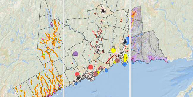
The report and appendices below describe the two-county vulnerability assessment and its findings, concluding with a presentation of 63 specific geographic areas where adaptation and resilience opportunities can be identified to address flood-related risks, extreme heat, or both. Assessment tools described in this report can be used by communities in their own resiliency planning.
Download Vulnerability Assessment Report, Dec. 2021
Appendix A: Stakeholder Workshop Reports
Appendix B: Social Vulnerability Mapping Resource Review
Appendix C: Flood and Heat CCVI Contributor List
Appendix D: TOD and Future Planned Development Review
Appendix E: TOD Heat and Flood CCVI Summary Statistics
Appendix F: Zones of Shared Risk Narratives
Appendix G: TOD and ZSR analysis
Appendix H: Affordable Housing with Proximity to TOD
Executive Summary:
This shorter document provides a high-level review of the full report's vulnerability analysis and importantly, is organized by the four Council of Governments for a better understanding of regional vulnerability. A description of vulnerability through the lense of assets and infrastructure in the two counties is also described as are the 63 identified specific areas for resilience opportunities.
Regional Opportunity Area Map Download
The following set of New Haven and Fairfield County's 63 resilience opportunity maps are organized by four focus areas: 1) transit oriented development with 40 maps, 2) affordable house with 11 maps, 3) wastewater treatment with 4 maps, and 4) public water supply with 8 maps. Each location's map link is a two page document with information summarized in both English and Spanish. A Spanish Translated Map Legend is also available HERE.
Transit Oriented Development / Desarrollo Orientado al Tránsito
| Location | Name | English/Spanish PDF File |
|---|---|---|
| Ansonia | Ansonia | Map Link |
| Branford | Branford Center | Map Link |
| Bridgeport | East Bridgeport | Map Link |
| Bridgeport | Downtown Bridgeport | Map Link |
| Bridgeport | South End | Map Link |
| Danbury | Danbury/Brookfield | Map Link |
| Danbury | Downtown Danbury | Map Link |
| Danbury | Lake Kenosia/Airport | Map Link |
| Darien | Darien | Map Link |
| Derby | Derby | Map Link |
| Fairfield | Downtown Fairfield | Map Link |
| Fairfield | Fairfield Metro | Map Link |
| Georgetown | Branchville/Georgetown | Map Link |
| Greenwich | Cos Cob | Map Link |
| Greenwich | Greenwich | Map Link |
| Guilford | Guilford Town Center | Map Link |
| Meriden | Downtown Meriden | Map Link |
| Milford | Devon | Map Link |
| Milford | Downtown Milford | Map Link |
| Naugatuck | Downtown Naugatuck | Map Link |
| New Haven | Fair Haven/Mill River | Map Link |
| New Haven | Long Wharf | Map Link |
| New Haven | Port Area | Map Link |
| North Haven | North Haven | Map Link |
| Norwalk | Merritt 7 | Map Link |
| Norwalk | South Norwalk | Map Link |
| Norwalk/Darien | Rowayton | Map Link |
| Seymour | Downtown Seymour | Map Link |
| Stamford | Downtown Stamford | Map Link |
| Stamford/Darien | Holly Pond | Map Link |
| Stratford | Airport/Lordship Gateway | Map Link |
| Stratford | Downtown Stratford | Map Link |
| Stratford | South End | Map Link |
| Wallingford | Wallingford Center | Map Link |
| Wallingford | Yalesville | Map Link |
| Waterbury | Downtown Waterbury | Map Link |
| Waterbury | Waterville | Map Link |
| West Haven | West Haven | Map Link |
| Westport | Downtown Westport | Map Link |
| Westport | Saugatuck | Map Link |
Affordable Housing / Viviendas subvencionadas
| Location | Name | English/Spanish PDF File |
|---|---|---|
| East Haven | East Haven Beach Area | Map Link |
| East Haven | East Haven Center | Map Link |
| Fairfield | Fairfield Reef Road Corridor | Map Link |
| Fairfield | Fairfield University Area | Map Link |
| Milford | Point Beach | Map Link |
| Milford | Walnut Beach | Map Link |
| New Haven | Westville | Map Link |
| North Haven | North Haven Center | Map Link |
| Stratford | Putney Area | Map Link |
| Wallingford | Wallingford Center | Map Link |
| West Haven | Savin Rock | Map Link |
Wastewater Treatment / Plantas de Tratamiento de Aguas Residuales
Public Water Supply / Sistemas y Fuentes de Agua Pública
| Location | Name | English/Spanish PDF file |
|---|---|---|
| Bethel/Danbury | Eureka Lake Watershed | Map Link |
| Brookfield | Federal Road | Map Link |
| Cheshire/Hamden/North Haven | Lake Whitney Watershed | Map Link |
| East Haven/North Branford | Lake Saltonstall Watershed | Map Link |
| Monroe | Easton Reservoir Watershed | Map Link |
| Monroe | Stepney | Map Link |
| New Fairfield | New Fairfield Center | Map Link |
| Redding | John Reade Middle School | Map Link |